
A popular outdoor activity in Colorado involves using the numerous trails and open spaces. However, with extensive human activity comes constant trail maintenance that can be costly and timely.
An incoming University of Northern Colorado graduate student is hoping to help one Colorado city better maintain its trails and open spaces so people can continue to enjoy the outdoors.
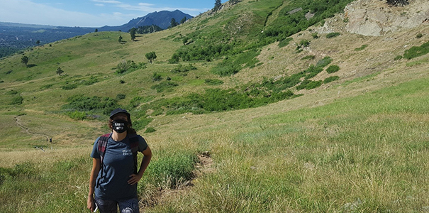
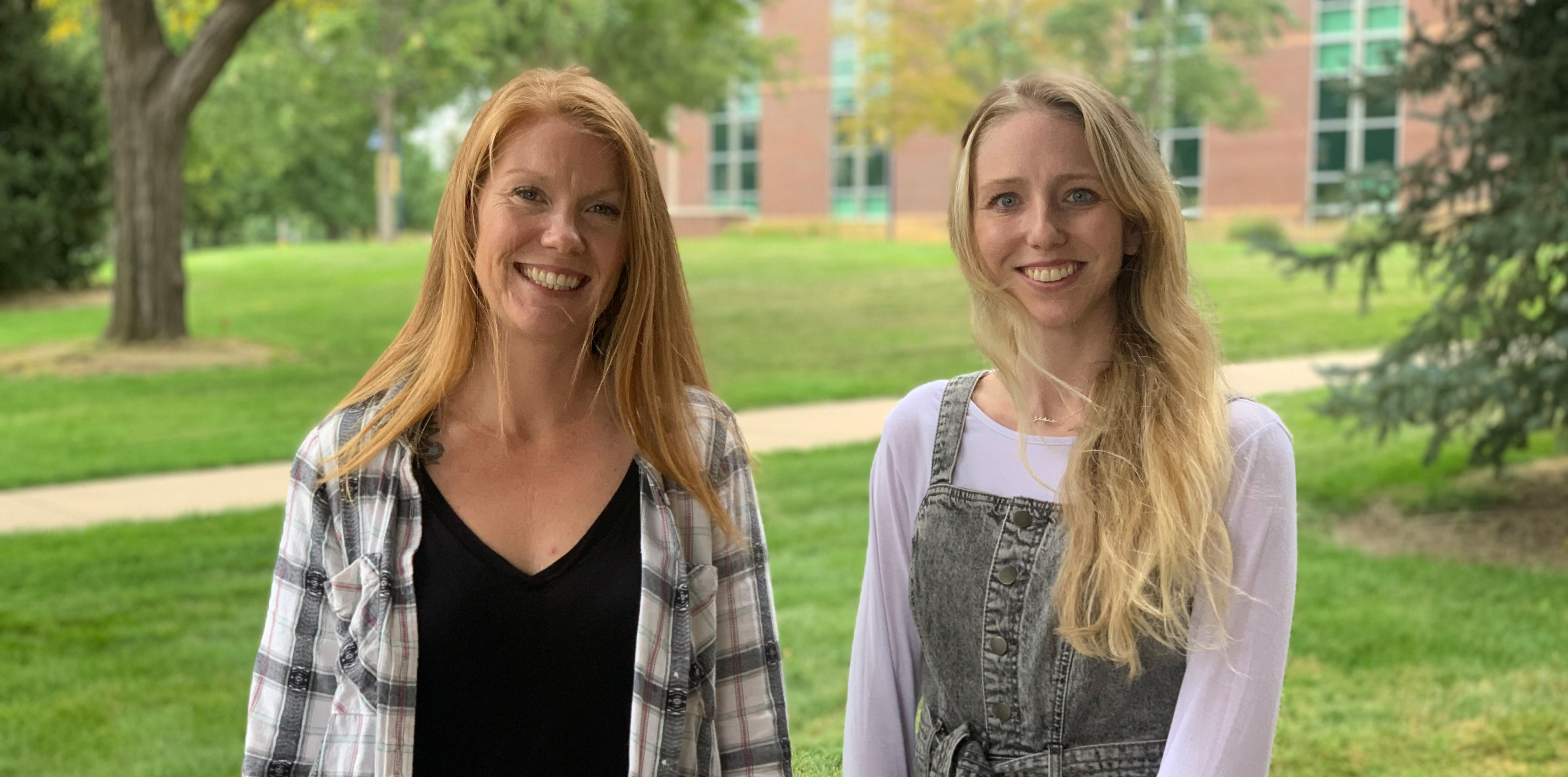
Top Image:Ara Metz in a Boulder natural area conducting reconnaissance work. Photo courtesy of Sharon Bywater-Reyes.
Originally from Kansas City, Missouri, Ara Metz is starting her graduate studies this fall in UNC’s Earth Sciences program. An avid outdoor lover, she received her bachelor’s degree last year in Environmental Science from the University of West Florida.
Metz is going to work with UNC’s Sharon Bywater-Reyes, Ph.D., an assistant professor of Environmental Geoscience, and Chelsie Romulo, Ph.D., an assistant professor in the Department of Geography, GIS, and Sustainability on a research project from a one-year, $10,000 City of Boulder grant. The research will focus on the city’s extensive trails through the use of drones and ground data collection to better understand the level of erosion that’s occurring.
“We’re going to look at all of these different variables to enable the City of Boulder's Open Space and Mountain Parks to plan their trails, if they need to do trail maintenance or just looking at the conditions of undesignated trails that people make on their own,” Metz said.
Metz and others will focus their efforts the foothills near Hogback Ridge, Wonderland Hill, Dakota Ridge and Flatiron region. They’ll produce a map of these areas that shows the different geomorphic processes that are occurring, such as landslides. After the map is produced and the data is reviewed, Metz will work with the City of Boulder better understand the rates and types of erosion occurring in these open spaces.
There’s a total of 46,300 acres of open space as well as 155 miles of managed, designated trails by the City of Boulder Open Space and Mountain Parks (OSMP). A recent report estimates that Boulder experiences an annual visitation at 6.26 million visits per year to these outdoor areas.
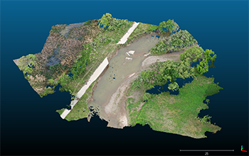
Above: An example of a three-dimensional model of a landscape created with a remote-sensing
method that takes overlapping photos. Bywater-Reyes developed this specific river
landscape in a previous course that she taught at UNC.
The completed statistical model will help them better understand and control erosion occurring in these areas. Then they’ll use community outreach with evidence-based information to inform users of these natural areas of how human and animal activity impacts the trails in terms of erosion and others. Metz estimates the overall grant research project will take around two years to complete.
“OSMP does regular trail condition surveys to study the long-term effects of trail management, and soil erosion has a large impact on the maintenance and condition of trails,” Jacob Engelman, a trail research coordinator with the City of Boulder OSMP, said. “This study could help OSMP understand how different soil types react differently to use-patterns and natural environmental processes.”
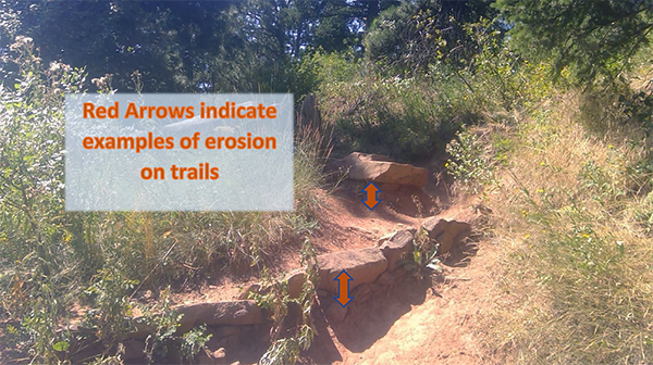
Above: An example of trail erosion in Boulder. Photo courtesy of City of Boulder OSMP.
One of the city’s biggest concerns is the impacts that off-trail use has on soil erosion and other effects on the open and natural areas. “Research regarding soil erosion rates and geomorphological processes on the landscape can support OSMP in data-driven management plans and work prioritization for the restoration of undesignated trails, as well as designated trail repairs and maintenance,” Engelman said.
“The City of Boulder is interested in understanding what influences the longevity of their trail-building efforts. As such, we are combining our interested to understand how the geologic template may influence erosion and degradation of the OSMP trail system,” Bywater-Reyes said. “To this end, we will use a method of remote sensing that takes overlapping photos to create a three-dimensional model of a landscape that we will be able to characterize the hillslopes with this model and look for erosion ‘hot spots.’”
Metz always dreamed of moving to Colorado to continue her academic career, and her dream came true when Bywater-Reyes and Romulo reviewed her application and reached out about the grant research project.
 “Sharon and Chelsie have been talking with the City of Boulder since January of this
year, and I put my application in and did the steps of applying to UNC,” Metz (image at right) said. “Sharon reached out to me and was like, ‘Your background, your undergrad and
your experience are exactly what we're looking for, and we're able to take on one
grad student to do this research.’ So, I got really lucky with that.”
“Sharon and Chelsie have been talking with the City of Boulder since January of this
year, and I put my application in and did the steps of applying to UNC,” Metz (image at right) said. “Sharon reached out to me and was like, ‘Your background, your undergrad and
your experience are exactly what we're looking for, and we're able to take on one
grad student to do this research.’ So, I got really lucky with that.”
Alongside Metz previous role working with NASA Develop as an intern where she utilized NASA satellites and remote sensing to determine water quality parameters for a National Estuarine Research Reserve in Alabama, her other experiences made her a perfect fit for the graduate assistant for this research project.
“Ara’s background in earth science with applications in remote sensing and environmental problem solving was perfect for the project,” Bywater-Reyes said.
Metz researched numerous institutions and their programs to find one that fit her goals. The Earth Science program at UNC stood out to her because it’s flexible, affordable, and a smaller university that allows her to do research that interests her.
“I came from a smaller university, and so, I really liked being able to go to another smaller university,” she said. “You get that interpersonal relationship that you just don't get at bigger schools.”
Learning to Use Drones at UNC
There are six UNC faculty members who are Federal Aviation Administration-licensed drone pilots. Students have the opportunity to learn and practice with those faculty members in using drones to conduct research and collect data.
Email Jim Doerner, chair of the UNC Department of Geography, GIS, and Sustainability, for more information.
Metz also discussed how helpful the faculty members have been in communicating with her and preparing her for her graduate school experience and research with the City of Boulder.
“I haven't actually met half of them yet in person or actually even know who they are, but I've been talking to them for months over email and figuring out stuff,” she said. “Everybody's been super helpful and I've heard great things, and I’m excited about getting to explore and check out the campus and do all of that kind of fun stuff.”
Grant Information
- Grant title: “Quantifying Erosion Susceptibility as a Function of Geomorphic Variables, Trail
Type, and Use with Implications for Trail Planning.”
- Grant from:City of Boulder Open Space and Mountain Parks
- Lead Principal Investigator: Sharon Bywater-Reyes, Ph.D.
- Co-Principal Investigator: Chelsie Romulo, Ph.D.
- Description: Many City of Boulder Open Space and Mountain Park (OSMP) trails traverse erodible
geologic units prone to land sliding and erosion. Erosion susceptibility is a key
consideration for trail sustainability, directly related to the OSMP and could be
especially important for management of undesignated trails.
This project proposes integrating existing OSMP data (LiDAR, trail condition, trail use) with new data (drone-collected imagery and structure from motion topography; SfM) across geomorphic process domains (foothills near Hogback Ridge, Wonderland Hill, Dakota Ridge, and Flatiron region) to determine how erosion varies as a function of geomorphic (slope, process domain) and land use variables.
Digital elevation models from SfM will be created and used for topographic change detection. In-situ measurements will be taken at key areas of concern, such as undesignated trails. Funding is requested for the first year of study with plans to continue for multiple years to capture how erosion dynamics vary as a function of precipitation regime.” - More information: https://bouldercolorado.gov/osmp/funded-projects
—Written by Katie Corder
More Stories
-
Alumna Receives NSF Graduate Fellowship for Avian Conservation Research
Este artículo no está en español.
-

Novel and Interdisciplinary Research on Transgender Health
Este artículo no está en español.
-
Grad Students Researching Methods to Strengthen Mental Health Training in Rural Schools
Este artículo no está en español.
-

Doctoral Students Present Dissertation Projects in Three-Minute Competition
Este artículo no está en español.